Skip to content
Welcome To Our Store.
100,000+ Products for Home, Medical, Office & Classroom Needs
Search
Skip to product information
1 of 1

The Queen's Atlas: Saxton's Elizabethan Masterpiece - Hardcover

$55.00 USD
$55.00 USD
Sale Sold out
Shipping calculated at checkout.
In stock (12 units), ready to be shipped

Available Offers

Fastest Delivery Tomorrow With Vip DealOrder within 1 hr 8 mins.

Instant 10% Discount On HDFC Banks Credit/Debit Cards EMI and CreditCard

Secure checkout with
  • American Express
  • Apple Pay
  • Diners Club
  • Discover
  • Google Pay
  • Mastercard
  • PayPal
  • Shop Pay
  • Visa
  • Daily deals
  • Return policy
  • Payment method
  • Help center 24/7

Flight Range: Up to 1,000 meters (3,280 feet)

Maximum Speed: 45 kilometers per hour (28 miles per hour)

For all orders exceeding a value of 100USD shipping is offered for free.

Returns will be accepted for up to 10 days of Customer’s receipt or tracking number on unworn items. You, as a Customer, are obliged to inform us via email before you return the item.

Otherwise, standard shipping charges apply. Check out our delivery Terms & Conditions for more details.

View Product Details
Shopping cart
Product Product subtotal Quantity Price Product subtotal
The Queen's Atlas: Saxton's Elizabethan Masterpiece - Hardcover
$55.00/ea
$0.00
$55.00/ea $0.00

Product Description

by David Fletcher (Author)

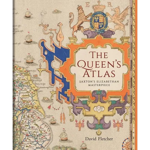
A cartographic snapshot of late Tudor England, gorgeously reproduced with the first county maps of England and Wales.

Nowadays, we take for granted the ready availability of maps of all kinds, but in Tudor England, maps were rare. All this changed in 1579 when Christopher Saxton, a farmer from the West Riding of Yorkshire, became the first cartographer to make a published atlas of all the counties of England and Wales. This book traces the story of Saxton's life and legacy by reconstructing his extraordinary mapmaking project alongside the crucial nature of the support and encouragement he received from Queen Elizabeth I and her court.

Saxton's atlas became the template for most detailed maps of the country for almost two centuries. For many, his atlas provided the first detailed image of England and Wales they had ever seen, showing the Elizabethan kingdom as a whole and in its constituent parts. This lavishly illustrated book reproduces all of Saxton's county maps together with many other drawings revealing the forebears and successors of this groundbreaking work. Today, Saxton's maps give us an invaluable cartographic snapshot of late Tudor England.

Author Biography

David H. Fletcher is an independent researcher specializing in the history of English and Welsh cartography in the early modern and modern eras.

Number of Pages: 232
Dimensions: 1.01 x 9.91 x 8.31 IN
Publication Date: January 06, 2026
you might like