Skip to content
Welcome To Our Store.
100,000+ Products for Home, Medical, Office & Classroom Needs
Search
Skip to product information
1 of 2

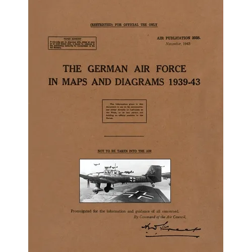
The German Air Force in Maps and Diagrams 1939-43 - Paperback

$34.56 USD
$34.56 USD
Sale Sold out
Shipping calculated at checkout.
In stock (100 units), ready to be shipped

Available Offers

Fast delivery available on most orders

Multiple secure payment options accepted

Secure checkout with
  • American Express
  • Apple Pay
  • Diners Club
  • Discover
  • Google Pay
  • Mastercard
  • PayPal
  • Shop Pay
  • Visa

Flight Range: Up to 1,000 meters (3,280 feet)

Maximum Speed: 45 kilometers per hour (28 miles per hour)

For all orders exceeding a value of 100USD shipping is offered for free.

Returns will be accepted for up to 10 days of Customer’s receipt or tracking number on unworn items. You, as a Customer, are obliged to inform us via email before you return the item.

Otherwise, standard shipping charges apply. Check out our delivery Terms & Conditions for more details.

View Product Details
Shopping cart
Product Product subtotal Quantity Price Product subtotal
The German Air Force in Maps and Diagrams 1939-43 - Paperback
$34.56/ea
$0.00
$34.56/ea $0.00

Product Description

by Air Publication 3038 (Compiled by)

Air Publication 3038. November, 1943.

(RESTRICTED) FOR OFFICIAL USE ONLY.

NOT TO BE TAKEN INTO THE AIR.


The intention of this official Air Publication was to provide an outline of the German Air Force from 1939 to 1943. Historically it focuses on the period in which the Germans were finding aggression successful. Published for training purposes, each map or diagram is complemented by a full and authoritative descriptive narrative. The publication is of much use for the air historian today, and bringing it back into print after 75 years will help the broad study of the Air War 1939-45.

This visual method was found useful by intelligence officers and includes sections relating to:

Operational Areas of Commands; Administrative & Supply Areas; Flying Units; Army & Naval co-operation; Air Transport; Supply & Maintenance; Signals; Training, each supported with interesting maps and/or diagrams. The work covers the Fronts in Europe, Russia and North Africa, with Appendices on Functions of the Luftflotten, Fliegerkorps & Lufgaus; Moves of the Fliegerkorps; Functions of Airfield Commands; Ground Organisation in North Africa (March, 1943); Flying Units & Their Mobility; Naval Co-operation & Air Transport (Employment of).



Number of Pages: 94
Dimensions: 0.26 x 11 x 8.5 IN
Publication Date: February 08, 2023
you might like