Skip to content
Save 5% on your next order with code PREMIUM5!
100,000+ Products for Home, Medical, Office & Classroom Needs
Search
Skip to product information
1 of 1

History of Cities in Maps: The Ultimate Visual Exploration of Human Civilisation Through 70 Captivating Historical Maps - Hardcover

$51.82 USD
$51.82 USD
Sale Sold out
Shipping calculated at checkout.
In stock (22 units), ready to be shipped

Available Offers

Fast delivery available on most orders

Multiple secure payment options accepted

Secure checkout with
  • American Express
  • Apple Pay
  • Diners Club
  • Discover
  • Google Pay
  • Mastercard
  • PayPal
  • Shop Pay
  • Visa

Flight Range: Up to 1,000 meters (3,280 feet)

Maximum Speed: 45 kilometers per hour (28 miles per hour)

For all orders exceeding a value of 100USD shipping is offered for free.

Returns will be accepted for up to 10 days of Customer’s receipt or tracking number on unworn items. You, as a Customer, are obliged to inform us via email before you return the item.

Otherwise, standard shipping charges apply. Check out our delivery Terms & Conditions for more details.

View Product Details
Shopping cart
Product Product subtotal Quantity Price Product subtotal
History of Cities in Maps: The Ultimate Visual Exploration of Human Civilisation Through 70 Captivating Historical Maps - Hardcover
$51.82/ea
$0.00
$51.82/ea $0.00

Product Description

by Philip Parker (Author), Collins Books (Author)

A fascinating cartographic study of urban development, perfect for map and history lovers.

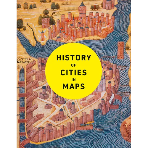
The city, a concept nearly as old as history itself, is a paradox of human innovation and intervention, order and conflict. From ancient civilisations to modern-day metropolises, maps have played a crucial role in urban progress. This book explores the development of cities through more than 70 captivating maps.

Each map in this beautifully designed volume gives a unique visual representation of and historical context to the city it surveys. Spanning more than 4,500 years, this book expertly curates more than 70 historical maps which tell the fascinating story of human civilisation: from cities founded on sacred places, ideas and power, to early examples of town planning and later innovations such as skyscrapers and urban transport.

Featuring maps of renowned capital cities as well as lesser-known urban areas, including:

  • Mohenjo-Daro, c. 2500 BC
  • Babylon, c. 600 BC
  • Rome, c. 210 AD
  • Baghdad, 762 AD
  • Constantinople, 1422
  • Tenochtitlan, 1524
  • Dublin, 1610
  • Kyoto, 1626
  • New Amsterdam, 1660
  • Edinburgh, 1780
  • Adelaide, 1838
  • Lagos, 1885
  • Los Angeles, 1908
  • Brasilia, 1957
  • Chongqing, 2016
  • Dubai, 2020

Author Biography

A historian and Sunday Times bestselling author with The Northman's Fury, who studied at Cambridge and Johns Hopkins University.

He has written widely on late antiquity, the early Middle Ages and world history, and his unique panoramic history of the nation was published by Collins: History of Britain in Maps.

He lives in London.

Number of Pages: 224
Dimensions: 0.9 x 10.7 x 8.2 IN
Publication Date: November 26, 2024
you might like