Skip to content
Welcome To Our Store.
100,000+ Products for Home, Medical, Office & Classroom Needs
Search
Skip to product information
1 of 1

Color Maps! Towns and Cities of Canada: Western Canada - Paperback

$16.45 USD
$16.45 USD
Sale Sold out
Shipping calculated at checkout.
In stock (100 units), ready to be shipped

Available Offers

Fastest Delivery Tomorrow With Vip DealOrder within 1 hr 8 mins.

Instant 10% Discount On HDFC Banks Credit/Debit Cards EMI and CreditCard

Secure checkout with
  • American Express
  • Apple Pay
  • Diners Club
  • Discover
  • Google Pay
  • Mastercard
  • PayPal
  • Shop Pay
  • Visa
  • Daily deals
  • Return policy
  • Payment method
  • Help center 24/7

Flight Range: Up to 1,000 meters (3,280 feet)

Maximum Speed: 45 kilometers per hour (28 miles per hour)

For all orders exceeding a value of 100USD shipping is offered for free.

Returns will be accepted for up to 10 days of Customer’s receipt or tracking number on unworn items. You, as a Customer, are obliged to inform us via email before you return the item.

Otherwise, standard shipping charges apply. Check out our delivery Terms & Conditions for more details.

View Product Details
Shopping cart
Product Product subtotal Quantity Price Product subtotal
Color Maps! Towns and Cities of Canada: Western Canada - Paperback
$16.45/ea
$0.00
$16.45/ea $0.00

Product Description

by Jason Petho (Author)

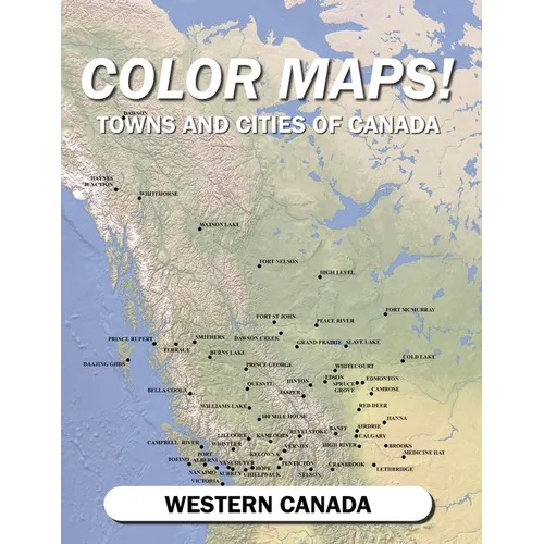
Color Maps! Towns and Cities of Canada is a coloring book series that brings joy as you watch a map come to life with color. Each volume in the series will cover different towns and cities throughout Canada.

This volume focuses on different towns and cities in western Canada. Each map is produced at a scale of 1:100,000. This scale allows one to see a detailed landscape of the countryside around the populated places. The landscape is divided into symbolized polygons to help you interpret the landscape and decide how to color the maps

The maps are based on satellite classification data developed at the turn of the century, allowing you to see a snapshot of the past.

Pro-tip: To see a sample of the maps, click on Look Inside, then choose Surprise Me from the menu.

Thank you for your interest!

Jason Petho is a professional cartographer with decades of experience and has a keen passion for history and maps.
Number of Pages: 120
Dimensions: 0.25 x 11 x 8.5 IN
Publication Date: April 20, 2023
you might like