Skip to content
Welcome To Our Store.
100,000+ Products for Home, Medical, Office & Classroom Needs
Search
Skip to product information
1 of 1

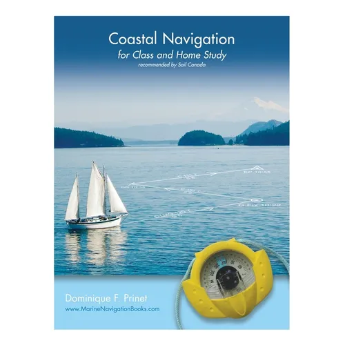
Coastal Navigation: for Class and Home Study - Paperback

$33.82 USD
$33.82 USD
Sale Sold out
Shipping calculated at checkout.
In stock (100 units), ready to be shipped

Available Offers

Fastest Delivery Tomorrow With Vip DealOrder within 1 hr 8 mins.

Instant 10% Discount On HDFC Banks Credit/Debit Cards EMI and CreditCard

Secure checkout with
  • American Express
  • Apple Pay
  • Diners Club
  • Discover
  • Google Pay
  • Mastercard
  • PayPal
  • Shop Pay
  • Visa

Flight Range: Up to 1,000 meters (3,280 feet)

Maximum Speed: 45 kilometers per hour (28 miles per hour)

For all orders exceeding a value of 100USD shipping is offered for free.

Returns will be accepted for up to 10 days of Customer’s receipt or tracking number on unworn items. You, as a Customer, are obliged to inform us via email before you return the item.

Otherwise, standard shipping charges apply. Check out our delivery Terms & Conditions for more details.

View Product Details
Shopping cart
Product Product subtotal Quantity Price Product subtotal
Coastal Navigation: for Class and Home Study - Paperback
$33.82/ea
$0.00
$33.82/ea $0.00

Product Description

by Dominique F. Prinet (Author)

Coastal Navigation for Class and Home Study is based on the notes prepared for students by the author during some 20 years of teaching navigation, initially to private or commercial pilots, and then to sailors and professional mariners.

The book is copiously illustrated with graphics which explain chart projections, scales and symbols, and describe lights and other navigation aids. It demystifies the True, Magnetic and Compass Norths as well as problems of time, speed and distances, and explains how to plot courses and take bearings, or draw regular and advanced Lines of Position using the international system of labeling.

The book further clarifies the use of vectors to easily determine the impact of a current on the boat speed and direction, and goes on to show how to evaluate tides and currents. The final sections describe the use of GPS and electronic charts, highlighting their limitations. Additional notes and explanations are given in the areas where students traditionally experience difficulties, as well as supplementary examples and exercises.

The companion book, Coastal Navigation Exercises, offers all the exercises needed for practice.
Number of Pages: 144
Dimensions: 0.39 x 11 x 8.5 IN
Publication Date: January 09, 2017
you might like

