Product Description
by Matt Brown (Author), Rhys B. Davies (Author)
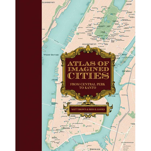
Explore the fictional topography of the most inspiring world cities--including London, New York, Los Angeles, Paris, and Tokyo--in this new book from the creators of the award-winning Atlas of Imagined Places.
Did you know that James Bond and George Smiley were practically neighbors, or that girls-about-town Holly Golightly, Annie Hall, and Carrie Bradshaw all lived a couple of blocks from one another? Fourteen of the most stunning city maps show exactly where your characters lived, loved, worked, and played. Find out where to enjoy a coffee from Central Perk (Friends), a butterbeer in the Leaky Cauldron (Harry Potter), or a revolutionary tipple in the Defarge Wine Shop (A Tale of Two Cities). Navigate round London's fictional tube network, from Walford East (EastEnders) to Hobbs End (Quatermass). Or fly between cities on one of a dozen fictional airlines (mapped to their home airports). Characters' homes, bars, clubs, metro stations, and skyscrapers that you've seen or read about are all plotted in beautiful vintage-style city maps. The maps draw from the movies, TV, novels, video games, and more, all painstakingly tracked down, mapped, annotated, and wittily divulged by the authors. Let them show you how to get to Sesame Street, and thousands of other places, in this indispensable guidebook to all those places you always wanted to visit...if only they were real.Author Biography
Matt Brown is author of 11 books for Batsford, using his trademark humor and playfulness as tools to explore the world. He has served as editor and editor-at-large of Londonist.com, writing on topics as diverse as street art, politics, mapmaking, and science. With a deep love of trivia, he's written and hosted hundreds of quizzes, including events for the Museum of London and Manchester Science Museum, among many others. He is tweeting at @mattfromlondon. Rhys B. Davies hails from South Wales. As a child of the nineties, he was reared on a mix of Saturday-morning cartoons, blockbuster films, and all manner of literature, coalescing into a deep love of fiction and the worlds that imagination can build