Skip to content
Welcome To Our Store.
100,000+ Products for Home, Medical, Office & Classroom Needs
Search
Skip to product information
1 of 1

Atlas of Geographical Wonders: From Mountaintops to Riverbeds - Hardcover

$50.00 USD
$50.00 USD
Sale Sold out
Shipping calculated at checkout.

Available Offers

Fastest Delivery Tomorrow With Vip DealOrder within 1 hr 8 mins.

Instant 10% Discount On HDFC Banks Credit/Debit Cards EMI and CreditCard

Secure checkout with
  • American Express
  • Apple Pay
  • Diners Club
  • Discover
  • Google Pay
  • Mastercard
  • PayPal
  • Shop Pay
  • Visa

Flight Range: Up to 1,000 meters (3,280 feet)

Maximum Speed: 45 kilometers per hour (28 miles per hour)

For all orders exceeding a value of 100USD shipping is offered for free.

Returns will be accepted for up to 10 days of Customer’s receipt or tracking number on unworn items. You, as a Customer, are obliged to inform us via email before you return the item.

Otherwise, standard shipping charges apply. Check out our delivery Terms & Conditions for more details.

View Product Details
Shopping cart
Product Product subtotal Quantity Price Product subtotal
Atlas of Geographical Wonders: From Mountaintops to Riverbeds - Hardcover
$50.00/ea
$0.00
Sold out
$50.00/ea $0.00

Product Description

by Jean-Christophe Bailly (Author), Gilles Palsky (Author), Jean-Marc Besse (Author)

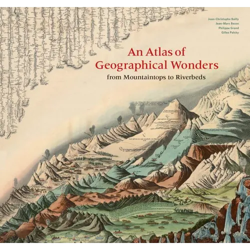
This is the first book to catalog comparative maps and tableaux that visualize the heights and lengths of the world's mountains and rivers. Produced predominantly in the nineteenth century, these beautifully rendered maps emerged out of the tide of exploration and scientific developments in measuring techniques. Beginning with the work of explorer Alexander von Humboldt, these historic drawings reveal a world of artistic and imaginative difference. Many of them give way--and with visible joy--to the power of fantasy in a mesmerizing array of realistic and imaginary forms. Most of the maps are from the David Rumsey Historical Map Collection at Stanford University.

Author Biography

Gilles Palsky is a professor of geography at the University of Paris. He has published a history of statistical cartography of the nineteenth century.

Jean-Christophe Bailly teaches the history of landscape formation at the École d'ingénieurs paysagistes (School of Landscape Architecture), Blois, France.

Jean-Marc Besse is director of research at the Centre national de la recherche scientifique (UMR Géographie-cités).

Philippe Grand is the author of nine books of poetry and publisher of Fage editions of Lyon, France.


Number of Pages: 208
Dimensions: 0.9 x 11.7 x 12.2 IN
Illustrated: Yes
Publication Date: September 24, 2019
you might like