Skip to content
Welcome To Our Store.
100,000+ Products for Home, Medical, Office & Classroom Needs
Search
Skip to product information
1 of 1

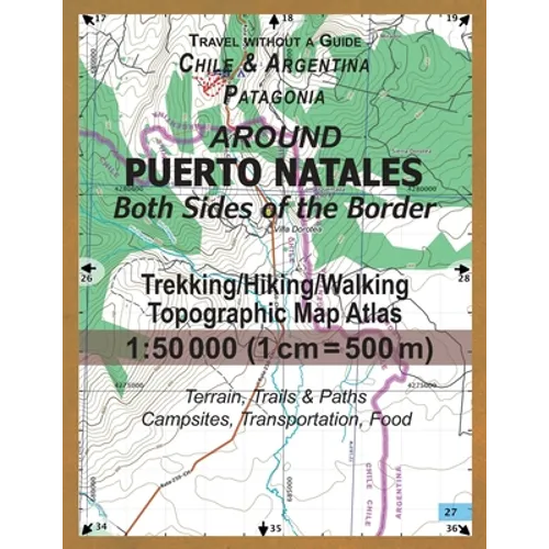
Around Puerto Natales Both Sides of the Border Trekking/Hiking/Walking Topographic Map Atlas 1: 50000 (1cm=500m) Chile & Argentina Patagonia 2017 Terr - Paperback

$20.18 USD
$20.18 USD
Sale Sold out
Shipping calculated at checkout.
In stock (100 units), ready to be shipped

Available Offers

Fastest Delivery Tomorrow With Vip DealOrder within 1 hr 8 mins.

Instant 10% Discount On HDFC Banks Credit/Debit Cards EMI and CreditCard

Secure checkout with
  • American Express
  • Apple Pay
  • Diners Club
  • Discover
  • Google Pay
  • Mastercard
  • PayPal
  • Shop Pay
  • Visa

Flight Range: Up to 1,000 meters (3,280 feet)

Maximum Speed: 45 kilometers per hour (28 miles per hour)

For all orders exceeding a value of 100USD shipping is offered for free.

Returns will be accepted for up to 10 days of Customer’s receipt or tracking number on unworn items. You, as a Customer, are obliged to inform us via email before you return the item.

Otherwise, standard shipping charges apply. Check out our delivery Terms & Conditions for more details.

View Product Details
Shopping cart
Product Product subtotal Quantity Price Product subtotal
Around Puerto Natales Both Sides of the Border Trekking/Hiking/Walking Topographic Map Atlas 1: 50000 (1cm=500m) Chile & Argentina Patagonia 2017 Terr - Paperback
$20.18/ea
$0.00
$20.18/ea $0.00

Product Description

by Sergio Mazitto (Author)

This detailed, full color topographic atlas represents the area around Puerto Natales, a port town close to the famous Torres del Paine National Park in Chilean Patagonia. Río Turbio and Veintiocho de Noviembre, villages on the Argentinian side of the border are also shown, with their access roads.Also shown is the peninsula Antonio Varas and the Fjord of Last Hope/Seno Última Esperanza, from Puerto Bories to Puerto Toro with the coastal line and terrain beyond, useful for reference on marine excursions to Glaciar Balmaceda and Glaciar & Laguna Serrano (also shown) in the Bernardo O'Higgins National Park.The details included in the topographic maps of this Atlas were specifically selected to be useful for trekkers, hikers and walkers of all interests, and make it easy to plan and enjoy both short excursions and hikes as well as long multi-day adventures. Terrain relief elevation contours are drawn every 20 meters.The map scale of 1:50000 (1 cm = 500 meters) provides a wealth of detail while keeping low the weight of the atlas itself. The large page format of 8.5x11in minimizes page count and along with the overlapping map design allows for comfortable navigation. With this ultralight map atlas you will always have a detailed, reliable, information-rich, battery-independent, shatter-proof map for your adventure. Mercator projection SAD69 with both UTM and WGS84 coordinate grids.


Number of Pages: 44
Dimensions: 0.11 x 11 x 8.5 IN
Publication Date: December 20, 2017
you might like
