Skip to content
Welcome To Our Store.
100,000+ Products for Home, Medical, Office & Classroom Needs
Search
Skip to product information
1 of 1

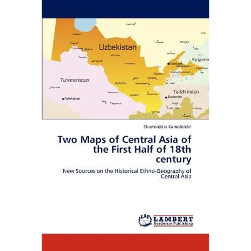
Two Maps of Central Asia of the First Half of 18th century - Paperback

$76.21
$76.21
Sale Sold out
Shipping calculated at checkout.
In stock (100 units), ready to be shipped

Available Offers

Fastest Delivery Tomorrow With Vip DealOrder within 1 hr 8 mins.

Instant 10% Discount On HDFC Banks Credit/Debit Cards EMI and CreditCard

Secure checkout with
  • American Express
  • Apple Pay
  • Diners Club
  • Discover
  • Google Pay
  • Mastercard
  • PayPal
  • Shop Pay
  • Visa

Flight Range: Up to 1,000 meters (3,280 feet)

Maximum Speed: 45 kilometers per hour (28 miles per hour)

For all orders exceeding a value of 100USD shipping is offered for free.

Returns will be accepted for up to 10 days of Customer’s receipt or tracking number on unworn items. You, as a Customer, are obliged to inform us via email before you return the item.

Otherwise, standard shipping charges apply. Check out our delivery Terms & Conditions for more details.

View Product Details
Shopping cart
Product Product subtotal Quantity Price Product subtotal
Two Maps of Central Asia of the First Half of 18th century - Paperback
$76.21/ea
$0.00
$76.21/ea $0.00

Product Description

by Kamoliddin Shamsiddin (Author)

Historical maps and globes made in Europe and Russia in 16th - 18th centuries are important sources for research of ethno-political history of Central Asia during that period. This book includes detailed description and discussion of two historical maps of Central Asia made in the first half of 18th century, where the terms "Uzbek", "Uzbekia" or "Uzbekistan" are used to mean Central Asia as synonyms of the term "Turkistan". The first map named "New Map of the Caspian Sea and the Usbek Country" (Tabula Nova de Mare Caspium et Usbekorum region) made in 1728 by Abraham Maas (active 1700 - 1735), a Dutch mapmaker at the Russian court in Saint-Petersburg where he worked in the Geographical Department of the Academy of Sciences. It was published by Johann Peter van Ghelen (1673 - 1754) in atlas of Homann Heirs in 1735 in Nuremberg. The second map named "The Map of the Caspian Sea and the Aral Sea" (Tabula Maris Caspii et Maris Aral) made in 1730 by Basilio Batatzis, a Greek traveler from Constantinopol, was published by John Senex, mapmaker of the Royal Geographic Society in 1732 in London. Medieval maps made in Western Europe testify that modern name "Uzbekistan" had historical roots.

Number of Pages: 64
Dimensions: 0.15 x 9 x 6 IN
Publication Date: November 09, 2012
you might like