Skip to content
Welcome To Our Store.
100,000+ Products for Home, Medical, Office & Classroom Needs
Search
Skip to product information
1 of 1

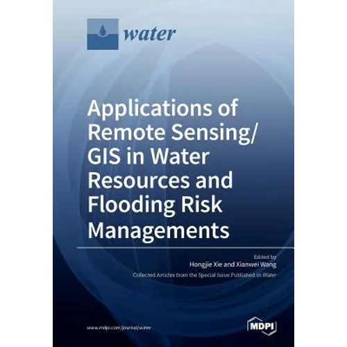
Applications of Remote Sensing/ GIS in Water Resources and Flooding Risk Managements - Paperback

$73.62
$73.62
Sale Sold out
Shipping calculated at checkout.
In stock (100 units), ready to be shipped

Available Offers

Fastest Delivery Tomorrow With Vip DealOrder within 1 hr 8 mins.

Instant 10% Discount On HDFC Banks Credit/Debit Cards EMI and CreditCard

Secure checkout with
  • American Express
  • Apple Pay
  • Diners Club
  • Discover
  • Google Pay
  • Mastercard
  • PayPal
  • Shop Pay
  • Visa

Flight Range: Up to 1,000 meters (3,280 feet)

Maximum Speed: 45 kilometers per hour (28 miles per hour)

For all orders exceeding a value of 100USD shipping is offered for free.

Returns will be accepted for up to 10 days of Customer’s receipt or tracking number on unworn items. You, as a Customer, are obliged to inform us via email before you return the item.

Otherwise, standard shipping charges apply. Check out our delivery Terms & Conditions for more details.

View Product Details
Shopping cart
Product Product subtotal Quantity Price Product subtotal
Applications of Remote Sensing/ GIS in Water Resources and Flooding Risk Managements - Paperback
$73.62/ea
$0.00
$73.62/ea $0.00

Product Description

by Hongjie Xie (Guest Editor), Xianwei Wang (Guest Editor)

Remote sensing and GIS play critical roles in water resource and flood inundation mapping and risk management. Remote sensing provides data sources for mapping water resources (snow and glaciers, water bodies, soil moisture and groundwater), measuring hydrological fluxes (ET, precipitation and river discharge), and monitoring drought and flooding inundation, while GIS provides the best tools for water resources, drought and flooding risk management and for setting up hydrologic models, inputting data processing and output analyses and visualizations. This Special Issue Book presents the best practices, cutting-edge technologies and applications of remote sensing, GIS and hydrologic models for water resources mapping, satellite rainfall measurements, runoff simulation, water body and flood inundation mapping and risk management. The latest technologies applied include 3D model analysis and visualization of glaciers, UAV video image classification for turf grass mapping and irrigation planning, ground penetration radar for soil moisture estimates, TRMM and GPM satellite rainfall measurements, storm hyetograph analysis, rainfall runoff and urban flooding simulation, satellite radar and optical image classification for urban water bodies and flooding inundation. The application of these technologies is expected to greatly relieve the pressures on water resources and assist in better mitigating and adapting to the impact of drought and flooding.

Number of Pages: 230
Dimensions: 0.63 x 9.61 x 6.69 IN
Illustrated: Yes
Publication Date: June 13, 2018
you might like